Getting to the Manaslu Region
Reaching the Manaslu region is an adventure in itself, as this remote trekking zone requires careful planning due to restricted access and limited infrastructure. The journey typically begins in Kathmandu, where you will need to arrange transportation to the trailhead at Soti Khola or Machha Khola. The most common and efficient way is by private jeep (8–10 hours), which navigates rough, winding roads through the scenic foothills of the Himalayas. Alternatively, you can take a local bus from Kathmandu to Arughat (a bustling market town) and then to Machha Khola.
For those seeking a quicker (but pricier) alternative, helicopter charters from Kathmandu can land closer to the trekking route. Once you arrive at the starting point, the real trek begins, passing through lush valleys, suspension bridges, and traditional villages before entering the Manaslu Conservation Area. Keep in mind that independent trekking is not allowed; you must be part of a registered trekking agency with a licensed guide, and checkpoints will verify your permits along the way.
Altitude
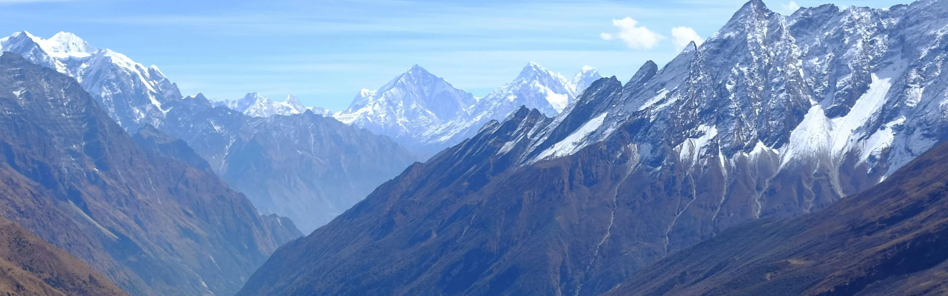
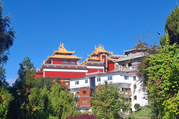
The Manaslu Circuit Trek takes you through a dramatic range of altitudes, from lush lowland valleys to high Himalayan passes, each with its own challenges and rewards. The trek begins at Machha Khola (930 m). The next day, we will head towards Jagat (1,340 m), where the landscape transitions into terraced hills and traditional villages. As you move higher, Deng (1,860m) and Namrung (2,630 m) offer stunning views of Manaslu’s foothills, while Lho Gaon (3,180m) introduces you to Tibetan-influenced culture and closer mountain vistas.
A key acclimatization stop is Samagaon (3,530 m), a picturesque village beneath the towering Manaslu Glacier. From here, you push toward Samdo (3,860 m), near the Tibetan border, before the ultimate challenge: crossing the Larkya La Pass (5,106 m). This is the highest and most demanding point.
The descent then leads through Bimthang (3,720 m), a serene high-altitude meadow, before gradually returning to lower elevations like Dharapani (1,860 m). Proper acclimatization is crucial, as altitudes above 3,000 m pose a risk of altitude sickness, making gradual ascent and rest days essential for a safe and enjoyable journey.
Terrain Conditions
The Manaslu Circuit Trek takes you through an ever-changing tapestry of terrain, each stretch offering its own challenges and scenic rewards. The journey begins in the lower valleys (700 m–2,000 m), where well-trodden dirt trails wind through lush subtropical forests, terraced farmlands, and cascading rivers, often crossing sturdy suspension bridges. As you ascend toward mid-elevation villages (2,000 m–3,500 m), the path becomes steeper and rockier, with exposed roots and loose stones, particularly around Deng and Namrung.
Beyond Samagaon (3,530 m), the landscape shifts to alpine moraines and glacial valleys, where trails are flanked by rugged boulders and icy streams. The most demanding section is the approach to Larkya La Pass (5,106 m), where trekkers navigate narrow, snow-dusted switchbacks, scree slopes, and potentially icy patches depending on the season.
After the pass, the descent into Bimthang opens up into grassy meadows and pine forests, with softer, muddy trails in monsoon months. Weather plays a huge role—dry seasons (Oct–Nov, Mar–Apr) offer firm footing, while post-rain or early winter treks may bring slippery mud or snow. Proper trekking boots and poles are essential to tackle this varied terrain safely.
Topography
The Manaslu Circuit Trek unfolds like a living geology textbook, taking you through seven distinct topographic zones in just 12–18 days. At Soti Khola (700 m), you will pass through colluvial valleys formed by the Budhi Gandaki River's erosion, where trails cut through loose conglomerate rock and clay-heavy soil. Between Jagat (1,340 m) and Deng (1,860 m), the path enters a V-shaped valley with steep schist cliffs, where waterfalls cascade over metamorphic rock folds.
Approaching Namrung (2,630 m), the terrain transitions to U-shaped valleys carved by ancient glaciers, now lined with moraine deposits and glacial erratics. The Samagaon (3,530 m) zone reveals a textbook cirque landscape. It’s a bowl-shaped valley formed by Manaslu's glaciers, with visible striations on bedrock and lateral moraines. The Larkya La Pass (5,106 m) itself is a high-altitude desert of frost-shattered shale, where periglacial features like patterned ground and solifluction lobes appear.
Descending to Bimthang (3,720 m), you will cross outwash plains of glacial meltwater before re-entering valleys near Dharapani. This unique progression, from river-cut gorges to glacial sculpting and high-altitude weathering, will make this trek diverse.
Trek Seasons for Manaslu Circuit Trek
The Manaslu Circuit Trek transforms dramatically with each season, offering unique adventures from snow-dusted passes to flower-filled valleys. But timing is everything—choose wisely, and you will be rewarded with stable trails, jaw-dropping vistas, and cultural encounters.
Pick the wrong window, and you might battle monsoons, icy winds, or closed routes. Let’s find your perfect trekking window!
Spring (March to May)
Spring is one of the prime seasons for the Manaslu Circuit, offering stable weather, crisp mountain views, and vibrant rhododendron forests in full bloom. Daytime temperatures range from 10°C to 20°C at lower elevations, while higher passes (like Larkya La) remain cold but manageable. The trails are less crowded than in autumn, making it ideal for those seeking solitude. However, occasional late snowfall can linger above 4,000m, so packing microspikes is wise. Wildlife is also more active, with chances to spot Himalayan pheasants and even the elusive snow leopard at higher altitudes.
Autumn (September to November)
Widely regarded as the best time for the Manaslu Circuit, autumn delivers crystal-clear skies, moderate temperatures (5°C–18°C), and minimal rainfall. The post-monsoon air is dust-free, offering unobstructed views of Manaslu (8,163m), Himalchuli, and the Ganesh Himal range.
Trails are dry and stable, and teahouses reopen after the monsoon, making logistics smooth. The downside? Higher crowds, especially in October—book guides and permits early. Nights get frosty above 3,500m, so a warm sleeping bag is essential.
Winter (December to February)
Winter transforms Manaslu into a silent, snow-clad wonderland but demands serious preparation. Daytime temps at lower elevations hover around 5°C–12°C, while Larkya La Pass plunges to -15°C with heavy snow. Many teahouses close, and routes may require ice axes and crampons.
Yet, for experienced trekkers, the rewards are empty trails, surreal frozen waterfalls, and Tibetan-style villages draped in winter tranquility. Avalanche risk near the pass means local guide expertise is critical.
Summer/Monsoon (June to August)
Monsoons bring lush greenery, fewer trekkers, and dramatic cloud displays, but they also bring heavyrainfall, landslides, and leeches to lower forests (below 2,500m). Trails turn muddy and slippery, and river crossings become hazardous. Some routes, like the Larkya La approach, may be snow-free but foggy, obscuring views. Only adventurous souls should attempt this season—waterproof gear, quick-dry clothing, and flexible itineraries are musts.
Permits
Trekking the Manaslu Circuit requires four essential permits, as the region falls under
restricted areas to protect its cultural and environmental integrity. Here’s what you need:
Manaslu Restricted Area Permit (RAP)
Manaslu Conservation Area Permit (MCAP)
Cost: USD 30 (valid for the entire trek duration).
Mandatory for entering the Manaslu Conservation Area, funding local conservation efforts.
Annapurna Conservation Area Permit (ACAP)
Local Area Permit
Additional Notes:
Permits are checked at multiple checkpoints (Jagat, Samagaon, Dharapani).
Bring passport copies (2–3) and passport-sized photos (2) for permit processing.
Altitude Difference and Acclimatization
The Manaslu Circuit Trek presents a dramatic altitude gain from 850 m at Machha Khola to 5,106 m at Larkya La Pass. So, careful acclimatization to avoid acute mountain sickness (AMS) is essential. The key to success lies in a gradual ascent profile. You should aim to sleep no more than 600–800 m higher than the previous night, with rest days built in at critical points like Samagaon (3,530 m).
The body’s adaptation slows above 3,500 m, making the stretch from Samdo (3,860 m) to Larkya La particularly risky. The symptoms, like headaches, nausea, or dizziness, demand immediate descent. Hydration (4–5 L daily), slow pacing ("pole pole"), and diamox prophylaxis (consult a doctor) help, but the terrain itself aids acclimatization.
The clockwise route’s longer approach allows better adaptation than rapid climbs like Everest Base Camp. Red flags (confusion, vomiting) indicate HACE/HAPE; carry a portable oxygen meter and know evacuation routes. Unlike the Annapurna Circuit, Manaslu’s steeper elevation curve leaves less room for error. Always listen to your guide’s advice on "climb high, sleep low" tactics near the pass.
Altitude Sickness Preparedness
The Manaslu Circuit Trek involves a rapid altitude gain from 870m at Machha Khola to 5,106m at Larkya La Pass. This might cause altitude sickness (AMS, HACE, HAPE), a serious risk. Manaslu’s steep ascent profile demands proactive acclimatization and emergency preparedness. Here is how to stay safe:
Gradual Ascent & Acclimatization Days
Follow the "climb high, sleep low" rule—never increase sleeping elevation by more than 300–400m per day above 3,000m.
Mandatory rest days: Samagaon (3,530m) and Samdo (3,860m) to help your body adjust.
Take short acclimatization hikes (e.g., Manaslu Base Camp from Samagaon) to boost oxygen uptake.
Medication & Prevention
Diamox (acetazolamide): Start 24–48 hours before reaching 3,000m (125mg twice daily; consult a doctor). Helps speed acclimatization.
Painkillers (ibuprofen): For mild altitude headaches, but if symptoms persist, descend immediately.
Carry emergency oxygen (portable cans) and a pulse oximeter (SpO2 below 75% is dangerous).
Recognize Symptoms & Act Fast
Mild AMS: Headache, nausea, fatigue → Rest, hydrate, monitor.
Severe AMS (HACE/HAPE):
HACE (brain swelling): Confusion, stumbling, vomiting → Descend 500 m+ immediately.
HAPE (lung fluid): Blue lips, breathlessness at rest → Evacuate ASAP; use oxygen.
Emergency Protocols
Helicopter evacuation is the only option for severe cases—ensure your travel insurance covers high-altitude rescue (up to 6,000m).
Guides carry PAC bags (portable hyperbaric chambers) on group treks—ask if yours does.
Pre-trip Preparations
Trekking the Manaslu Circuit requires thorough preparation—physical training, gear selection, and logistical planning—to ensure a safe and enjoyable adventure.
Build stamina with hiking, running, or cycling (3–4x weekly, 45+ mins).
If possible, train on hills or use a weighted backpack (10–15kg) to mimic trek conditions.
Travel insurance covering high-altitude emergencies (up to 6,000m).
Passport copies (2–3) and passport-sized photos for permits.
Understand daily distances, elevation gains, and challenges.
Discuss altitude meds (Diamox), vaccines (hepatitis, typhoid), and a dental checkup.
Include diarrhea meds, antiseptics, and any personal prescriptions.
Test all gear before flying (especially boots and backpacks).
Ways to Prevent Altitude Sickness
Follow "climb high, sleep low" rule (+300-400m/day max above 3,000m) with mandatory rest days in Samagaon (3,530m) and Samdo (3,860m)
Drink 4-5L water daily, eat carb-heavy meals (dal bhat/porridge), avoid alcohol/caffeine, and overexertion
Take Diamox (125mg 2x/day starting 1-2 days pre-trek) and carry ibuprofen + emergency meds (Dexamethasone for HACE and nifedipine for HAPE)
Track SpO2 (pulse oximeter; <85% = danger), recognize AMS symptoms (headache/nausea → mild; confusion/vomiting → severe)
Immediate 500 m+ descent if symptoms worsen, carry portable oxygen and ensure insurance covers helicopter rescue up to 6,000m
Packing List: Essential Gear
Packing the right gear for the Manaslu Circuit Trek is crucial for comfort, safety, and enjoyment. The weather in the Himalayas can be unpredictable, ranging from scorching sun to freezing snow, so a smart, layered approach is key. Below is a detailed breakdown of the essential gear you will need.
Clothing (Layering System for Changing Weather)
The layering system is the best way to adapt to fluctuating temperatures. Start with a moisture-wicking base layer (merino wool or synthetic) to keep sweat away from your skin. Add an insulating mid-layer (fleece or down jacket) for warmth, especially at higher altitudes. Your outer layer should be a windproof and waterproof shell jacket to protect against rain, snow, and harsh winds. For bottoms, pack thermal leggings, quick-dry trekking pants, and waterproof over-pants if needed. Don’t forget gloves (lightweight and insulated), a warm hat, a buff or neck gaiter, and sunglasses (UV-protected) to shield against glare from snow.
Footwear (Best Trekking Boots & Socks)
Your feet will be your most valuable asset on this trek, so invest in high-quality, waterproof, ankle-supporting trekking boots (broken in before the trip!). Brands like Salomon, Merrell, or La Sportiva are reliable. Pair them with moisture-wicking trekking socks (merino wool is ideal) to prevent blisters. Bring 2-3 pairs and rotate them to keep your feet dry. For teahouse evenings, lightweight camp shoes or sandals are a luxury you’ll appreciate.
Backpack Essentials (Sleeping Bag, Trekking Poles, etc.)
A 30- 40L backpack (with a rain cover) should suffice if you are using a porter. If carrying your own gear, a 60- 70L pack may be needed. Essential items include:
A 4-season sleeping bag (rated at least -10°C / 14°F) for cold teahouse nights.
Trekking poles (collapsible) to reduce knee strain on steep descents.
A duffel bag (if using a porter) with a lock for extra security.
Headlamp with extra batteries (power cuts are common).
Dry bags or waterproof stuff sacks to keep gear dry.
Power bank (solar-powered options are great for long treks).
Health & Safety (First Aid Kit, Water Purification)
Staying healthy at high altitudes is critical. Pack a well-stocked first aid kit including:
Altitude sickness medication (Diamox, as a precaution).
Painkillers, anti-diuretics, and rehydration salts.
Blister treatment (Compeed, moleskine).
Basic wound care (bandages, antiseptics).
For water purification, avoid single-use plastic bottles—instead, bring a reusable bottle and use it.
A small hygiene kit (wet wipes, hand sanitizer, biodegradable soap) and sunscreen (SPF 50+) are also must-haves.
Route and Itinerary Planning
The Manaslu Circuit Trek typically takes 12 to 14 days, offering a perfect blend of rugged trails, remote villages, and breathtaking Himalayan scenery. A classic itinerary starts in Soti Khola (or Machha Khola) and follows the Budhi Gandaki River, passing through lush forests, terraced fields, and traditional Tibetan-influenced settlements. Key highlights include Samagaon, Dharamsala, and the challenging yet rewarding Larkya La Pass (5,106m). From here, the route descends into the Annapurna region, ending in Besisahar or Dharapani, where you can connect to other treks or return to Kathmandu.
For those with extra time, side trips such as the sacred Tsum Valley (renowned for its ancient monasteries and unique culture) or a detour to Manaslu Base Camp (for closer Himalayan vistas) add depth to the journey. Proper acclimatization days, especially in Samagaon, are crucial to avoid altitude sickness while allowing time to explore nearby glacial lakes and monasteries. Careful planning ensures a balanced pace, maximizing both adventure and cultural immersion.
Altitude Sickness Prevention
Altitude sickness (Acute Mountain Sickness, or AMS) is a serious concern on the Manaslu Circuit Trek, especially when crossing the Larkya La Pass (5,106m). Proper preparation and awareness can prevent life-threatening complications. Below is a detailed guide on symptoms, prevention, and emergency protocols.
1. Symptoms of AMS (Acute Mountain Sickness)
Altitude sickness occurs when the body fails to acclimatize to reduced oxygen levels at high elevations. Symptoms usually appear 6–24 hours after ascending too quickly.
Mild to Moderate AMS Symptoms:
Severe AMS (Life-Threatening Conditions):
2. How to Avoid Altitude Sickness
Altitude sickness might be life-threatening if it is ignored or not treated properly. There are lots of ways to avoid altitude sickness, and I have listed below those points.
A. Gradual Ascent (Best Prevention Method)
Follow the "climb high, sleep low" rule.
Do not increase sleeping altitude by more than 300–500m per day above 3,000m.
Include acclimatization days (e.g., rest day in Samagaon at 3,530m).
B. Stay Hydrated
Drink 3–4 liters of water daily (avoid alcohol & caffeine).
Monitor urine color (clear = well-hydrated, dark = dehydrated).
C. Eat Properly
Consume carbohydrate-rich foods (easier to digest at altitude).
Avoid heavy, fatty meals that strain digestion.
D. Medication (Consult a Doctor Before Use)
Diamox (Acetazolamide): Helps speed up acclimatization (common dosage: 125mg twice daily, starting 1 day before ascent).
Ibuprofen/Paracetamol: For altitude headaches.
E. Listen to Your Body
3. Emergency Protocols
A. Immediate Actions for Severe AMS
Stop ascending.
Descend immediately (at least 500m or until symptoms improve).
Use oxygen (if available, some teahouses keep emergency oxygen).
Take medication (Dexamethasone for HACE, Nifedipine for HAPE—if prescribed).
B. Evacuation Plan
C. Prevention Over Cure
Budgeting and Costs
Trekking the Manaslu Circuit requires careful financial planning. Below is a detailed cost breakdown, money-saving tips, and guidance on tipping and emergencies.
A. Estimated Total Cost
The total cost depends on trekking style (independent vs. guided), season, and personal preferences. Here’s a rough estimate for a 14-day trek:
Permits (Mandatory)
Manaslu Restricted Area Permit (RAP):
Manaslu Conservation Area Permit (MCAP): ~$30.
Annapurna Conservation Area Permit (ACAP): ~$30 (if exiting via Annapurna).
Guide and Porter Fees (Mandatory)
Guide: $25–$35/day (includes their food, insurance, wages and lodging).
Porter: $20–$25/day (carries 15–20kg).
Food & Accommodation:
Teahouses: $5–$15/night (basic room).
Meals: $8–$10 per meal (Dal Bhat, noodles, snacks).
Miscellaneous:
Transport: $10–$50 (Kathmandu to Machha Khola by bus/jeep).
Travel Insurance: around $200 (must cover high-altitude rescue).
Extras: Hot showers ($3–$4), Wi-Fi ($2–$3).
B. Tips for Saving Money
Travel Off-Season: Permits and teahouses are cheaper (Dec-Aug, excluding monsoon).
Join a Group: Split guide/porter costs with other trekkers.
Pack Snacks: Bring energy bars, nuts, and chocolate from Kathmandu to avoid overpriced trail snacks.
Limit Extras: Skip Wi-Fi, hot showers, and bottled water (use purification tablets).
C. Tipping Culture (Guides & Porters)
Tipping is customary in Nepal and shows appreciation for hard work.
Guide: $5–$10/day (or 10–15% of total trip cost).
Porter: $3–$5/day (or $50–$80 total for the trek).
When to Tip: Hand cash directly at the end of the trek with a thank-you.
Bonus Tips:
D. Emergency Protocols
Altitude Sickness:
Descend immediately if symptoms (headache, nausea) worsen.
Carry Diamox (acetazolamide) but consult a doctor first.
Evacuation:
Financial Safety:
Final Checklist Before You Go on the Adventure
A last-minute check ensures you don't miss any essentials. Start with documents: double-check that your passport is valid for at least six months, and ensure you have printed copies of your permits. These include Manaslu Restricted Area Permit, MCAP, and ACAP, as well as travel insurance documents.
Next, review your packing list—confirm you have broken-in trekking boots, moisture-wicking layers, a warm sleeping bag (rated for -10°C), a headlamp, sunscreen, and a reusable water bottle with purification tablets. Don’t forget essentials like cash (Nepalese rupees for teahouses) and a portable charger. Finally, mentally prepare for the challenges ahead: the trek is physically demanding, with long days and unpredictable weather. Stay flexible, embrace the slow pace for acclimatization, and mentally visualize crossing the thrilling Larkya La Pass (5,106m). A positive mindset and adaptability will be just as crucial as your gear!
Conclusion
With the right preparation, from layered clothing to altitude-smart strategies, you are set for an unforgettable Himalayan adventure. Remember, every step through those rhododendron forests, across glacial rivers, and up to Larkya La's breathtaking summit is a story waiting to be lived. Stay flexible, listen to your body, and soak in the magic of Tibetan-style villages and jaw-dropping peaks. Need a last-minute tip? Your gear is your lifeline—pack smart, trek smarter!
Final Tips for Success:
Start slow: don’t rush the acclimatization process; listen to your body.
Pack smart: keep your backpack light but ensure you have essentials for cold nights and sudden weather changes.
Stay respectful: engage with locals, support teahouse owners, and follow eco-friendly practices.
Embrace the challenge: there will be tough days, but the sense of achievement at the end is unparalleled.
Have questions about permits, training, or gear? We will be happy to reply your queries, so email us if you have any. If you are hesitating, remember that every professional trekker was once a beginner. Trust your preparation, stay mindful of altitude risks, and soak in every moment.